
Cart 2 india
In2Cart
Rs. 0
0


Product Information
Specification
Binding : apparel
Brand : Wisdom Heart
BulletPoint1 : PERFECT WALL DECOR: fits into a standard frame size to make it unique to you and your home, without having to pay the price for a custom frame. Sure to match any home decor.
BulletPoint2 : HIGH QUALITY MATERIALS: Ensuring that you can enjoy your map for years to come, we use only the best available methods and materials including museum-grade, acid-free, matte finish paper, as well as archival inks rated to last a lifetime. We hand package your print rolled in a rigid mailing tube to ensure that it will be safe and protected during shipment.
BulletPoint3 : PRINTED ONLY WHEN YOU ORDER: To ensure that your print is of the best quality, we print one-at-a-time, on demand. We use the finest class of large-format, commercial photographic printers, archival paper and inks to ensure that you receive a high quality, made-to-last print. Nothing is printed until you place your order, ensuring you the same quality as a custom print without the price.
BulletPoint4 : FINE REPRODUCTION: We digitally clean and restore all our products to remove distracting flaws while carefully maintaining its historical character and nature.
BulletPoint5 : THE PERFECT GIFT: This print is perfect for the hard to buy member of your family who appreciates history, geography, cartography or fine art.
Color : Black
ExternallyAssignedProductIdentifier1 : 0712198742173
ExternallyAssignedProductIdentifier2 : 712198742173
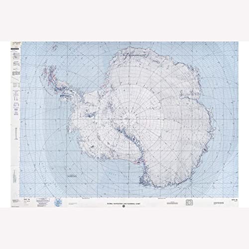
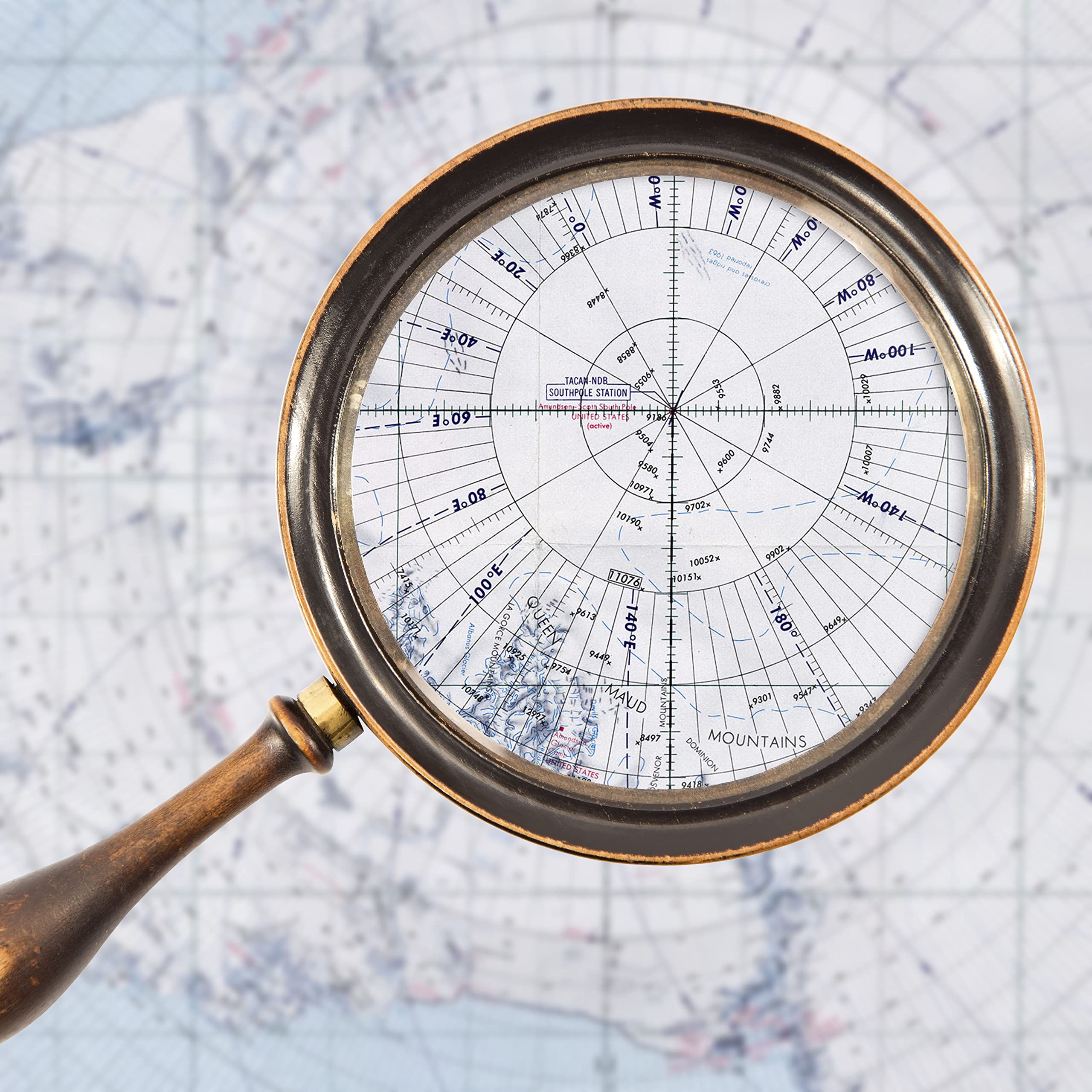
ItemName : Antarctica, NOAA Map, Global Navigation & Planning Chart, 1985 - 24 x 36 inches
ItemPackageQuantity : 1
ItemShape : Rectangular
ItemTypeKeyword : fishing-charts-and-maps
Manufacturer : Paradise Cay Publications, Inc.
MapType : Historical
Material : Copper
PaperFinish : matte
PartNumber : PR_1839_24L
Pattern : Solid
ProductDescription : NOAA's National Ocean Service produces nautical charts that contain information about the nature and form of the coast, the depths of the water and general character and configuration of the sea bottom, locations of dangers to navigation, the rise and fall of the tides, locations of navigation aids, and characteristics of the earth's magnetism.
ProductSiteLaunchDate : 2022-02-13T19:11:28.815Z
Size : 24X36 inches
Style : 5. Large Format Paper Chart - 42" x 51"
SubjectKeyword : 'reference', 'non-fiction'
UnspscCode : 55101500
WebsiteShippingWeight : 11.24 pounds