
Cart 2 india
In2Cart
Rs. 0
0


Product Information
Specification
Binding : poster
Brand : Captain Segull’s Sport Fishing Chart
BulletPoint : Default
BulletPoint1 : Waterproof, durable, lightweight card can handle exposure to any type of weather.
BulletPoint2 : Transparent card stock with both negative and positive sides for easier reading and comparing grain size in the field.
BulletPoint3 : Waterproof, durable, lightweight card can handle exposure to any type of weather
BulletPoint4 : 360˚ protractor with azimuth (0-360) and quadrant (0-90) markings
BulletPoint5 : 10 grain size classifications including phi scale
Color : Multi color, magenta fishing areas.
Department : ""
ExternallyAssignedProductIdentifier : 9420024184769
ExternallyAssignedProductIdentifier1 : 0653210115967
ExternallyAssignedProductIdentifier2 : 653210115967
Format : print
GpsrSafetyAttestation : 1
ImportDesignation : Made in the USA
IncludedComponents : Compass, Card Set
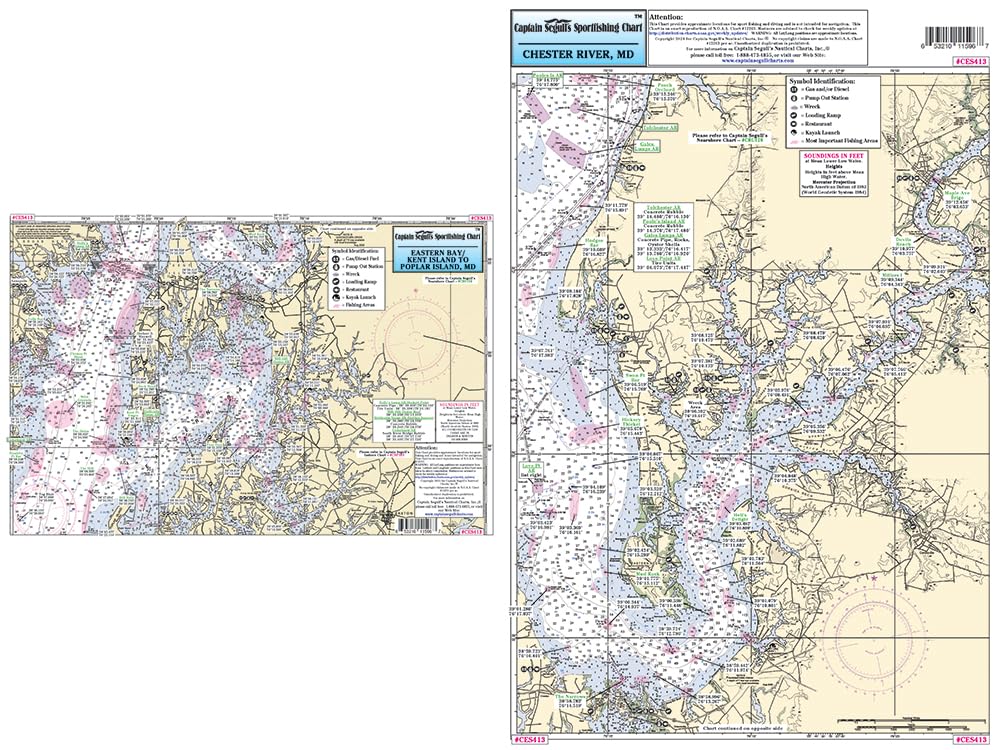
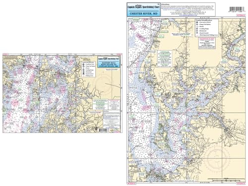
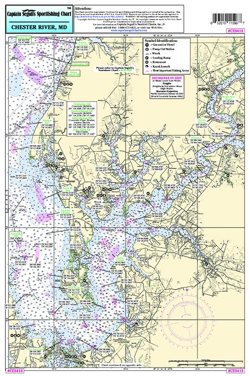
ItemName : Captain Segulls Inshore Chester River/Eastern Bay, MD, Fishing Nautical Chart #CES413
ItemPackageDimensions_Height : 1 inches
ItemPackageDimensions_Length : 1 inches
ItemPackageDimensions_Width : 1 inches
ItemPackageQuantity : 1
ItemTypeKeyword : fishing-charts-and-maps
Language : english
Manufacturer : Captain Segulls Nautical Charts, Inc
ManufacturerMinimumAge : 180
MapScale : 12" x 18"
Material : Acrylic
ModelName : 1L-OTN5-BKZF
ModelNumber : 1L-OTN5-BKZF
NumberOfBoxes : 1
NumberOfItems : 1
PackageLevel : unit
PartNumber : CES413
ProductDescription : Small Boat/Kayak Inshore Fishing chart Detail of Chester River from Chestertown south to Chester, MD side a and Eastern Bay from Chester to Poplar Island, MD. Double sided laminated fishing Chart. Shows fishing areas, wrecks, reefs, local names and amenities in GPS out to the thousandths of a minute. 12" x 18" Uses NOAA Charts 12263 & 12272
ProductSiteLaunchDate : 2024-05-14T15:03:28.339Z
PublicationDate : 2024T
Size : Einheitsgröße
Style : Map Multi-Tool Card + Grain Size Card
SupplierDeclaredDgHzRegulation : not_applicable
UnspscCode : 55101500
WarrantyDescription : Standard Manufacturer's Warranty