
Cart 2 india
In2Cart
Rs. 0
0


Product Information
Specification
Binding : miscellaneous
Brand : NOAA
BulletPoint1 : Size: 31.18 inches high by 42.69 inches wide.
BulletPoint2 : Printed on 46 pound paper
BulletPoint3 : Always printed to order to include all changes upto date of order.
BulletPoint4 : Meets U.S. and international carriage requirements for commercial vessels.
BulletPoint5 : U. S. Coast Guard approved
Color : Multicolor
ExternallyAssignedProductIdentifier1 : 071365307769
ExternallyAssignedProductIdentifier2 : 0071365307769
Format : folded_map
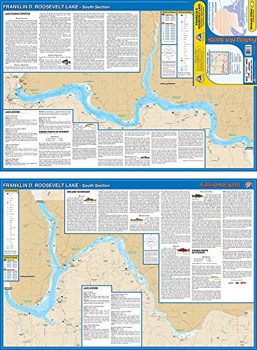
ItemName : Franklin D. Roosevelt Lake Fishing Map, Washington
ItemPackageDimensions_Height : 4 inches
ItemPackageDimensions_Length : 36 inches
ItemPackageDimensions_Width : 4 inches
ItemPackageQuantity : 1
ItemTypeKeyword : fishing-charts-and-maps
Language : english
Manufacturer : NOAA Nautical Charts
MapScale : 1:24,000
MapType : Recreation
ModelNumber : MT-13233
PaperFinish : premium_glossy
PaperSize : Letter
PartNumber : 18400
ProductDescription : 1:40000 Scale. Eastern U. S./Canada Region. 36.14'' H x 44.51'' W.
ProductSiteLaunchDate : 2023-09-25T18:57:28.232Z
PublicationDate : 2015T
ShipsGlobally : 1
SupplierDeclaredDgHzRegulation : not_applicable
UnspscCode : 55101500