
Cart 2 india
In2Cart
Rs. 0
0


Product Information
Specification
Binding : apparel
Brand : Captain Segull's Sportfishing Chart
BulletPoint : Laminated Fishing Chart
BulletPoint1 : Enlarged to 42 inches on the shortest side and scaled proportionately
BulletPoint2 : Always printed on-demand using the current NOAA data
BulletPoint3 : Printed by NOAA certified chart agent Paradise Cay Publications
BulletPoint4 : Excellent Quality
BulletPoint5 : Specifically printed for display - NOT for navigation
Color : laminated waterproof
ExternallyAssignedProductIdentifier1 : 0653210107603
ExternallyAssignedProductIdentifier2 : 653210107603
ImportDesignation : Made in USA
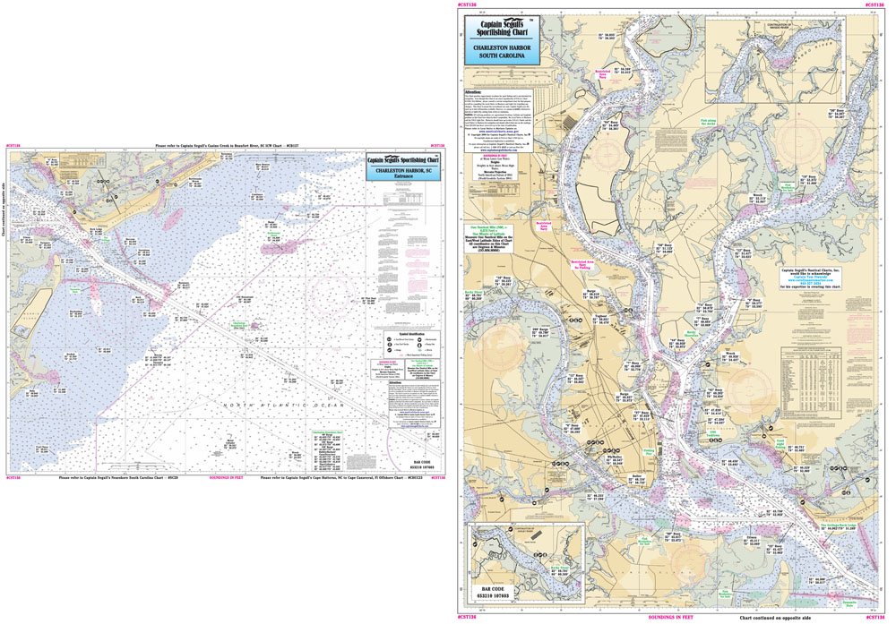
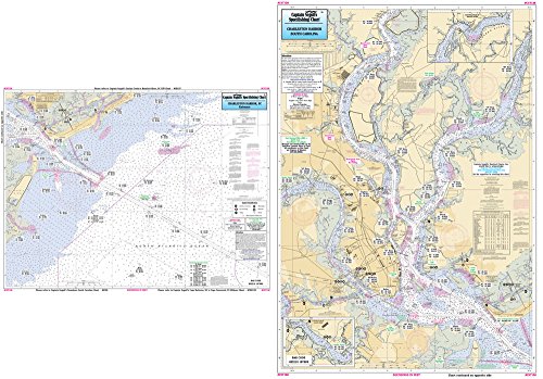
ItemName : Inshore Charleston Harbor, SC - Laminated Nautical Navigation & Fishing Chart by Captain Segull's Nautical Sportfishing Charts | Chart # CST136
ItemPackageDimensions_Height : 32.4 centimeters
ItemPackageDimensions_Length : 0.2 centimeters
ItemPackageDimensions_Width : 16.7 centimeters
ItemPackageQuantity : 1
ItemShape : Rectangle
ItemTypeKeyword : fishing-charts-and-maps
Language : english
Manufacturer : Captain Segull's Nautical Charts, Inc
MapType : Fishing
Material : Polypropylene
ModelNumber : 78F
NumberOfItems : 1
NumberOfPieces : 1
PaperFinish : coated
PaperSize : Letter
PartNumber : CST136
ProductDescription : Inshore Fishing Chart: An inshore chart highly detailed of Charleston Harbor and approaches. Side A, entrance and approaches of Charleston Harbor from Folly Island to Isle of Palms, Side B, Harbor with Ashley, Cooper and Wando RiversShows fishing areas, wrecks, reefs, local names and amenities in GPS out to the thousandths of a minute. 19.5" x 26.5"
ProductSiteLaunchDate : 2016-02-27T21:48:26.167Z
Size : 19.5" x 26.5"
Style : 5. Large Format Paper Chart
UnitCount : 1
UnspscCode : 55101500