
Cart 2 india
In2Cart
Rs. 0
0


Product Information
Specification
Brand : Captain Segull's Sportfishing Chart
BulletPoint : Laminated Fishing Chart
Color : laminated waterproof
ExternallyAssignedProductIdentifier1 : 0653210107184
ExternallyAssignedProductIdentifier2 : 653210107184
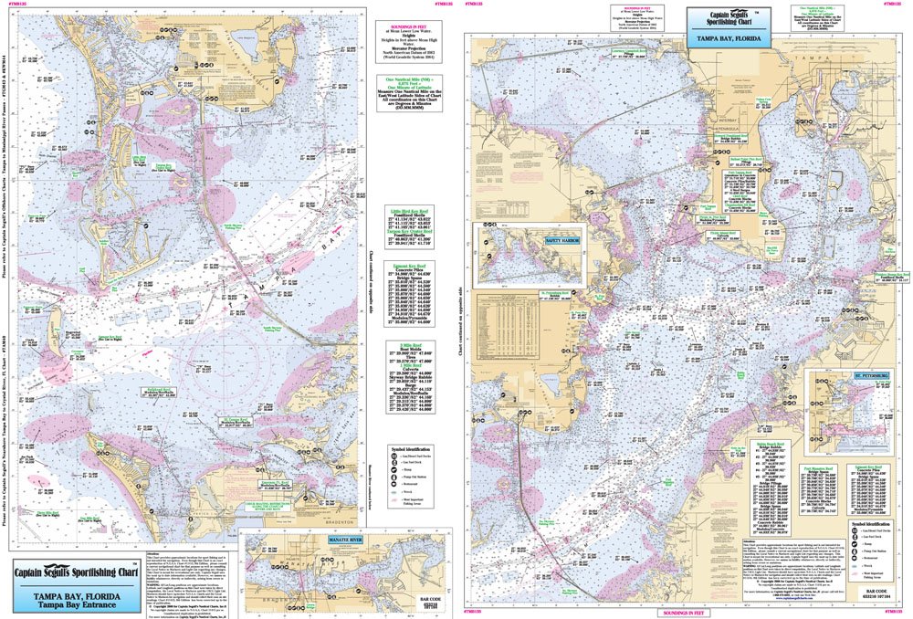
ItemName : Inshore Tampa Bay, FL - Laminated Nautical Navigation & Fishing Chart by Captain Segull's Nautical Sportfishing Charts | Chart # TMB135
ItemPackageQuantity : 1
ItemTypeKeyword : fishing-charts-and-maps
Manufacturer : Captain Segull's Nautical Charts, Inc
PartNumber : TMB135
ProductDescription : Inshore Fishing Chart: An inshore chart that covers Tampa Bay. Side A entrance of the bay in great detail, with an inset of Manatee River. Side B; Tampa Bay, Hillsborough Bay and Old Tampa Bay with insets of Safety Harbor and St. Petersburg Double sided laminated fishing Chart. Shows fishing areas, wrecks, reefs, local names and amenities in GPS out to the thousandths of a minute. 19.5" x 26.5"
ProductSiteLaunchDate : 2016-02-27T21:48:25.141Z
Size : 19.5" x 26.5"
UnspscCode : 60101700