
Cart 2 india
In2Cart
Rs. 0
0


Product Information
Specification
Binding : map
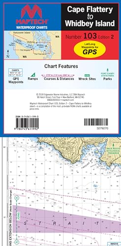
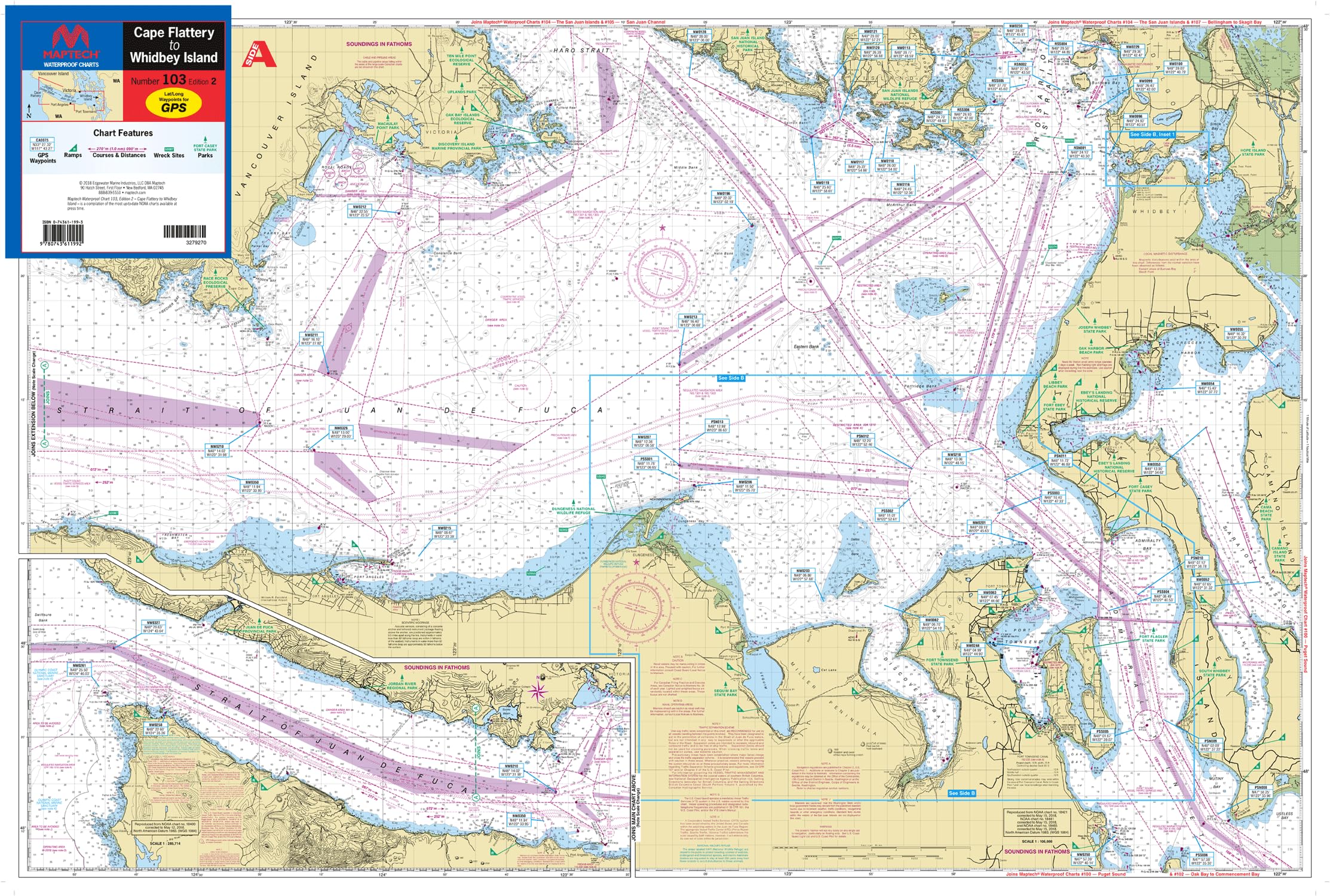
Brand : MAPTECH
BulletPoint : 12" x 18"
BulletPoint1 : Waterproof: Made of high-quality, waterproof synthetic paper, ensuring durability and resistance to water and moisture.
BulletPoint2 : Comprehensive Coverage: Covers the area from Cape Flattery to Whidbey Island, including the Strait of Juan De Fuca, with detailed insets of Dungeness Bay to Port Townsend.
BulletPoint3 : Navigational Aids: Features waypoints for major buoys and channels, pre-plotted courses, public boat launch locations, and state park information for easy navigation.
BulletPoint4 : Large Scale: Approximate scale of 1:106,600 and 1:53,300 (with insets), providing detailed and clear images for easy readability.
BulletPoint5 : Convenient Format: Flip-fold format measures 24" x 36" when open and 6" x 12" when folded, making it easy to carry and use on the go.
Color : Chart yellow, blue, green, black
ExternallyAssignedProductIdentifier : 4539625190668
ExternallyAssignedProductIdentifier1 : 0743611993
ExternallyAssignedProductIdentifier2 : 9780743611992
Format : folded_map
ItemName : MAPTECH Waterproof Chart, Cape Flattery to Whidbey Island, Strait of Juan De Fuca, edition 21:53,300 Scale, 24 x 36 inches Open, Flip-Fold Format
ItemPackageDimensions_Height : 11.8 centimeters
ItemPackageDimensions_Length : 2.2 centimeters
ItemPackageDimensions_Width : 4.5 centimeters
ItemPackageQuantity : 1
ItemShape : Rectangular
ItemTypeKeyword : fishing-charts-and-maps
Language : english
Manufacturer : MAPTECH®
MapScale : 106,600 and 1:53,300 with insets
ModelName : #QU105-005
MountingType : Wall Mount
NumberOfItems : 1
NumberOfPieces : 1
Orientation : Landscape
PaintType : Watercolor
PartNumber : WPC103-02
Pattern : Printed
ProductDescription : The MAPTECH Waterproof Chart WPC103-02 is an essential navigation tool for boaters exploring the waters from Cape Flattery to Whidbey Island, including the Strait of Juan De Fuca. This high-quality chart features detailed information on waypoints for major buoys and channels, pre-plotted courses, public boat launch locations, and state park information. With an approximate scale of 1:106,600 and 1:53,300, along with insets, this chart provides crisp and easy-to-read images. Crafted from waterproof synthetic paper, it's designed to withstand the elements, ensuring reliable use on the water. The flip-fold format measures 24 inches x 36 inches when open and a compact 6 inches x 12 inches when folded, making it convenient to store and transport. Whether you're a seasoned boater or exploring new waters, this MAPTECH chart is an invaluable resource for safe and enjoyable navigation.
ProductSiteLaunchDate : 2024-06-13T14:44:36.688Z
PublicationDate : 2018T
Size : 48L" x 36W"
Style : Retro
SupplierDeclaredDgHzRegulation : not_applicable
TargetGender : unisex
Theme : NOAA
UnspscCode : 55101500