
Cart 2 india
In2Cart
Rs. 0
0


Product Information
Specification
Binding : map
Brand : MAPTECH
BulletPoint1 : Waterproof: High-quality, waterproof synthetic paper ensures durability and protection against water damage.
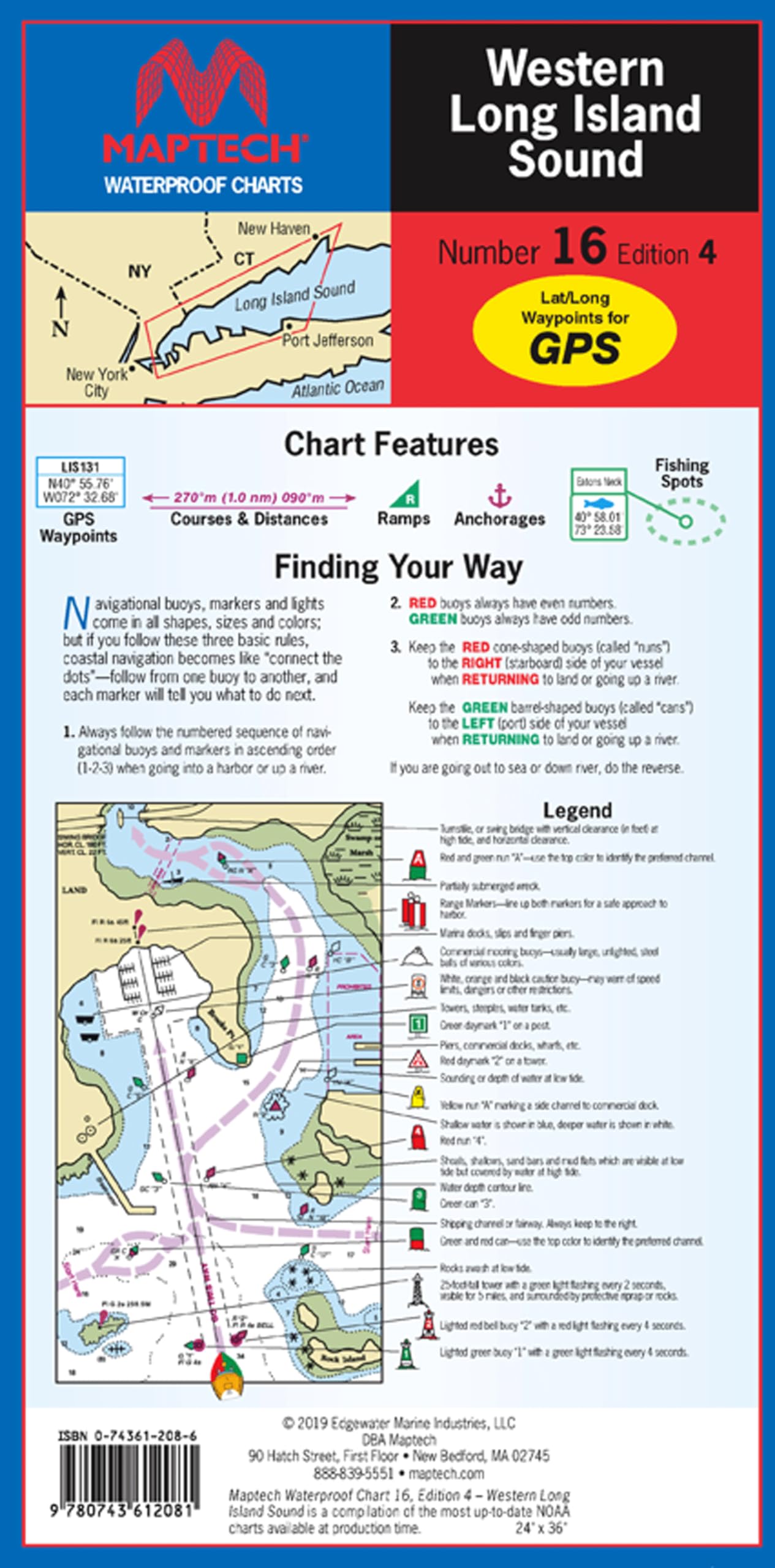
BulletPoint2 : Comprehensive Coverage: Detailed chart covers Western Long Island Sound from Throgs Neck, NY to Port Jefferson, NY and New Haven CT.
BulletPoint3 : Useful Information: Features waypoints for major buoys, courses and distances, fish/dive sites, and ramp locations.
BulletPoint4 : Large Scale: 1:50,000 scale with insets provides clear and detailed mapping over a 24" x 36" area.
BulletPoint5 : Convenient Format: Flip-fold design measures 24" x 36" when open and compact 6" x 12" when folded.
Color : Chart yellow, blue, green, black
ExternallyAssignedProductIdentifier1 : 0743612086
ExternallyAssignedProductIdentifier2 : 9780743612081
Format : folded_map
ItemName : MAPTECH Waterproof Chart, WPC016-04, Western Long Island Sound, 4th Edition. Throgs Neck to Port Jefferson, 24" x 36", 1:50,000 Scale, Waypoints, Fish/Dive Sites, Ramp Locations
ItemPackageDimensions_Height : 1 inches
ItemPackageDimensions_Length : 15 inches
ItemPackageDimensions_Width : 11 inches
ItemTypeKeyword : fishing-charts-and-maps
Language : english
Manufacturer : MAPTECH®
MapScale : 1:50,000 with insets. Informat
MapType : Navigational
PaperSize : 24 x 36 inches
PartNumber : WPC016-04
ProductDescription : MAPTECH Waterproof Chart WPC016-04 Western Long Island Sound. Throgs Neck, NY to Port Jefferson, NY and New Haven CT. Featuring waypoints for major buoys, courses and distances, fish/dive sites, and ramp locations and information. 24" x 36", scale 1:50,000 with insets.
ProductSiteLaunchDate : 2024-06-12T18:49:13.138Z
PublicationDate : 2019T
UnspscCode : 55101500