
Cart 2 india
In2Cart
Rs. 0
0


Product Information
Specification
Binding : map
Brand : East View Map Link
BulletPoint1 : Printed on heavy weight acid free paper.
BulletPoint2 : Printed on demand using the most up to date NOAA data and latest Notice to Mariners (NTMs) applied at time of print.
BulletPoint3 : Meets United States Coast Guard carriage requirements.
BulletPoint4 : Pre-production finishing for superior quality.
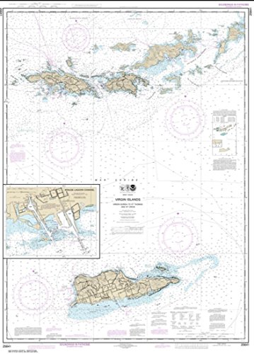
BulletPoint5 : Printed by East View Geospatial. Map scale: 1:100,000. Map size (inches): 45.7 x 32.8.
Color : full color
ExternallyAssignedProductIdentifier1 : 0071365901998
ExternallyAssignedProductIdentifier2 : 071365901998
Format : folded_map
ImportDesignation : Made in the USA
ItemName : NOAA Chart 25641-Virgin Islands-Virgin Gorda to St. Thomas and St. Croix; Krause Lagoon Channel by East View Geospatial
ItemPackageDimensions_Height : 0.1 inches
ItemPackageDimensions_Length : 11 inches
ItemPackageDimensions_Width : 8.5 inches
ItemPackageQuantity : 1
ItemTypeKeyword : fishing-charts-and-maps
Language : english
Manufacturer : East View Geospatial
MapScale : 1:24,000
MapType : Navigation
ModelNumber : TROUT & SALMON I.D. CHART #11
NumberOfItems : 1
NumberOfPieces : 1
PaperFinish : matte
PaperFinish1 : matte
PaperFinish2 : smooth
PaperSize : 45.7 x 32.8 inches
PartNumber : NOAA25641
ProductDescription : East View Geospatial (EVG) is a certified NOAA and NGA print on demand printer. Our nautical charts are printed using high resolution images. All NOAA nautical charts are printed by East View Geospatial.
NOAA-OCS cancelled this Raster and PDF chart. The product will NOT meet U.S. and international carriage requirements for commercial vessels defined in SOLAS Chapter V Regulation 19.2.1.
Printed on heavy weight acid free paper.Printed by East View Geospatial. Map scale: 1:100,000. Map size (inches): 45.7 x 32.8.
ProductSiteLaunchDate : 2015-07-17T21:31:24.843Z
PublicationDate : 2017-10-19T00:00:00.000-07:00
TargetSpecies1 : Trout
TargetSpecies2 : Salmon
UnitCount : 1
UnspscCode : 55101500