
Cart 2 india
In2Cart
Rs. 0
0


Product Information
Specification
Binding : map
Brand : Fishing Hot Spots
BulletPoint : Laminated Fishing Chart
BulletPoint1 : Printed on high quality waterproof and tear-resistant material
BulletPoint2 : Always printed on demand using the most recent NOAA data
BulletPoint3 : Prepared to be display quality. Arrives rolled, not folded.
BulletPoint4 : These waterproof charts satisfy USCG CARRIAGE REQUIREMENTS
BulletPoint5 : Handy 8.5 x 11 inch size. Page count varies depending on the chart.
Color : Multicolor
ExternallyAssignedProductIdentifier1 : 0071365002619
ExternallyAssignedProductIdentifier2 : 071365002619
Format : folded_map
Hazmat : auto-grounding
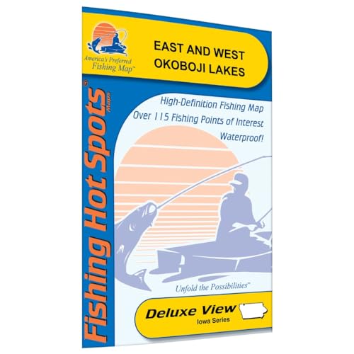
ItemName : Okoboji Lakes-East/West Fishing Map
ItemPackageQuantity : 1
ItemTypeKeyword : fishing-charts-and-maps
Language : english
Language1 : english
Language2 : english
Language3 : english
Language4 : english
Language5 : english
Manufacturer : Fishing Hot Spots
MapScale : 1:24,000
MapType : Recreation, Road
MapType1 : Freshwater
MapType2 : Freshwater
MapType3 : Freshwater
MapType4 : Freshwater
MapType5 : Freshwater
NumberOfItems : 1
PaperSize : 12x55 inches
PartNumber : M261
ProductDescription : West Okoboji, the second largest natural lake in Iowa, has a reputation for producing trophy fish, including the record muskie (38 lb, 5oz) and northern pike (25 lb., 5 oz.).East Okoboji produced the Iowa state record Buffalo (51 lbs.). Featured Species: Walleye, Smallmouth Bass, Yellow Perch, Bluegill, Carp, Freshwater Drum, Channel Catfish and Bullhead Map Features: Lake Profile Fishery Information Fishing Tips and Techniques 9Accesses with Driving Directions 70Proven Fishing Areas Marked
ProductSiteLaunchDate : 2023-09-25T18:56:58.630Z
PublicationDate : 2017-12-09T00:00:00.000-08:00
Size : 19.5" x 26.5"
Style : Traditional
SupplierDeclaredDgHzRegulation1 : not_applicable
SupplierDeclaredDgHzRegulation2 : not_applicable
SupplierDeclaredDgHzRegulation3 : not_applicable
SupplierDeclaredDgHzRegulation4 : not_applicable
SupplierDeclaredDgHzRegulation5 : not_applicable
UnspscCode : 55101500