
Cart 2 india
In2Cart
Rs. 0
0


Product Information
Specification
Brand : Paradise Cay Publications, Inc.
BulletPoint1 : Printed on high quality water-resistant paper
BulletPoint2 : Always printed on demand using the most recent data from NOAA
BulletPoint3 : Prepared to be display quality. Arrives rolled, not folded.
BulletPoint4 : Produced by the United Kingdom Hydrographic Office. One of the world's leading producers of nautical charts.
BulletPoint5 : Hook: #2 x 3
Color : DOT CHART
Configuration : Refer to description
CustomerPackageType : Standard Packaging
DeprecatedShaftStyleType : Refer to description
Edition : Standard Edition
ExternallyAssignedProductIdentifier : 4513473513640
ExternallyAssignedProductIdentifier1 : 0612524294829
ExternallyAssignedProductIdentifier2 : 612524294829
Flavor : Fig
HandOrientation : Refer to description
IncludedComponents : Refer to description
ItemDisplayDimensions_Length : 59.4 inches
ItemDisplayDimensions_Width : 41.5 inches
ItemDisplayWeight : 2 pounds
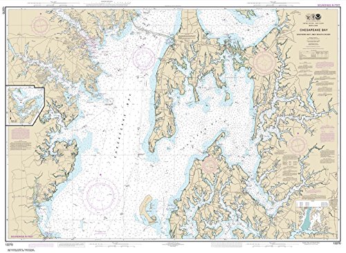
ItemName : Paradise Cay Publications, Inc. NOAA Chart 12270: Chesapeake Bay Eastern Bay and South River; Selby Bay, 35.5 X 48.4, Traditional Paper
ItemPackageDimensions_Height : 18.8 centimeters
ItemPackageDimensions_Length : 2.7 centimeters
ItemPackageDimensions_Width : 5.5 centimeters
ItemPackageQuantity : 1
ItemShape : Refer to Description
ItemTypeKeyword : fishing-charts-and-maps
Manufacturer : Paradise Cay Publications, Inc.
Material : Acrylonitrile Butadiene Styrene (ABS) Metal
MeasurementAccuracy : refer to description
ModelName : KANATA SW
ModelNumber : VT0D9QJWVTC6AM9A8P4E
NumberOfItems : 1
NumberOfPieces : 1
PartNumber : NO_11427
Pattern : Solid
ProductDescription : Admiralty standard nautical charts comply with Safety of Life at Sea (SOLAS) regulations and are ideal for professional, commercial and recreational use. Charts within the series consist of a range of scales, useful for passage planning, ocean crossings, coastal navigation and entering port. Mariners should always use the largest scale nautical chart appropriate to their needs. In particularly busy seaways such as the English Channel, Gulf of Suez and the Malacca and Singapore Straits, the standard nautical charts are supplemented by mariners' routeing guides which provide advice on route planning in these complex areas. Admiralty nautical charts are corrected to the latest notice to mariners (NTM) by our trained cartographer at the point of sale. It is the mariner's responsibility to maintain and correct the chart onwards to be in compliance with SOLAS regulations and to ensure safe navigation.
ProductSiteLaunchDate : 2014-10-10T00:00:00.000-07:00
Resolution : refer to description
Scent : Refer to description
Size : 160mm
SpecialSizeType : Refer to description
StreetDate : 2022-09-09T00:00:01Z
Style : Traditional
SupplierDeclaredDgHzRegulation : not_applicable
SupplierDeclaredHasProductIdentifierExemption : 1
TargetSpecies : Mackerel
UnitCount : 1
UnspscCode : 55101500
WeightRange : Refer to description