
Cart 2 india
In2Cart
Rs. 0
0


Product Information
Specification
Binding : map
Brand : Paradise Cay Publications
BulletPoint : Maptech WPC048, MAPWPC048
BulletPoint1 : 12 x 18 spiral-bound
BulletPoint2 : High quality durable paper
BulletPoint3 : Useful for reference and aboard small craft
BulletPoint4 : Crisp Imaging: Chart images are crisp and easy to read.
BulletPoint5 : Trusted Brand: MAPTECH is a renowned manufacturer of waterproof charts.
Color : Chart yellow, blue, green, black, red
CompatibleDevices : Smartphone
CompatibleDevices1 : ARC1
CompatibleDevices10 : QUA1
CompatibleDevices11 : DC1
CompatibleDevices12 : GC1
CompatibleDevices13 : SUC1
CompatibleDevices14 : TGT1
CompatibleDevices15 : RASPSB1
CompatibleDevices16 : SAC1
CompatibleDevices17 : TRNPL1
CompatibleDevices18 : ONX1
CompatibleDevices19 : ASC1
CompatibleDevices2 : MEC1
CompatibleDevices20 : THEC1
CompatibleDevices3 : SUN1
CompatibleDevices4 : TRN1
CompatibleDevices5 : RASP1
CompatibleDevices6 : RAS1
CompatibleDevices7 : MVRC1
CompatibleDevices8 : KNC1
CompatibleDevices9 : MUC1
ExternallyAssignedProductIdentifier1 : 1951116321
ExternallyAssignedProductIdentifier2 : 9781951116323
Format : folded_map
HardwarePlatform : Android
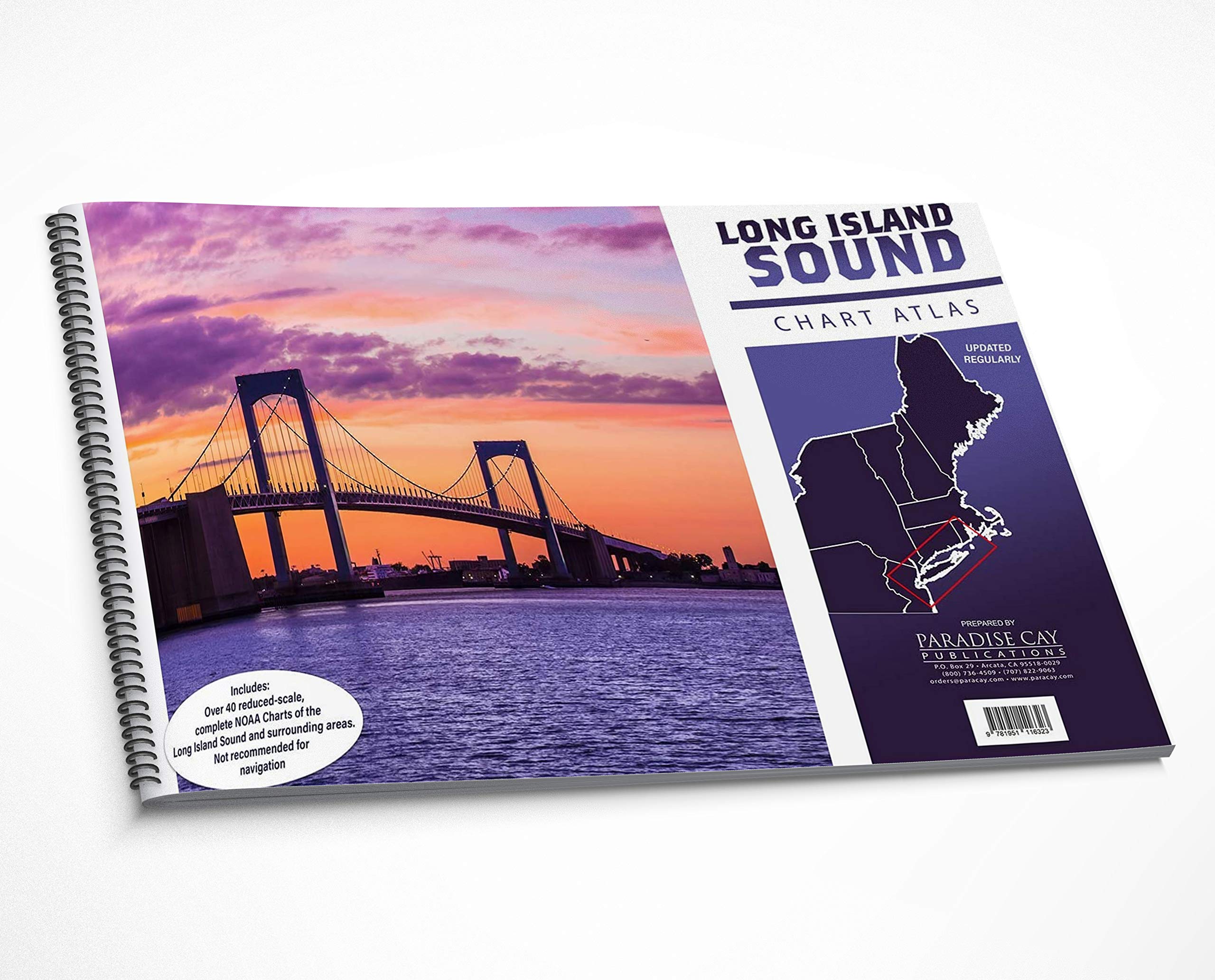
ItemName : Paradise Cay Publications Long Island Sound Chart Atlas (12 x 18 Spiral-Bound Book of Reduced-Scale NOAA Charts)
ItemPackageDimensions_Height : 44.958 centimeters
ItemPackageDimensions_Length : 0.762 centimeters
ItemPackageDimensions_Width : 29.972 centimeters
ItemPackageQuantity : 1
ItemTypeKeyword : fishing-charts-and-maps
Language : english
Manufacturer : Paradise Cay Publications
MapScale : 1:22222
MapType : North America
MapType1 : Topographic
MapType2 : Navigational
ModelNumber : MT-WPC057
MountingType : Wrist Mount
NumberOfItems : 1
OperatingSystem : Android
PaperFinish : specially_coated
PaperSize : 27 x 38 inches
PartNumber : WPC086-02
Pattern : Solid
ProductDescription : 43 reduced-scale complete NOAA charts of the Long Island Sound and surrounding areas. Spiral-bound in a large format (12x18") booklet. Printed on high-quality paper and updated regularly. Not recommended for navigation, but handy for reference and use aboard small craft. Includes the following NOAA charts: 12324 12325 12326 12327 12331 12332 12334 12335 12337 12338 12339 12341 12342 12345 12346 12350 12352 12353 12354 12358 12362 12363 12364 12365 12366 12367 12368 12369 12370 12371 12372 12373 12374 12375 12401 12402 13205 13209 13211 13212 13213 13214
ProductSiteLaunchDate : 2020-08-26T22:21:33.788Z
PublicationDate : 2016T
StreetDate : 2025-06-08T12:00:00.000Z
SupplierDeclaredDgHzRegulation : not_applicable
SupplierDeclaredHasProductIdentifierExemption : 1
UnspscCode : 60101700