
Cart 2 india
In2Cart
Rs. 0
0


Product Information
Specification
Binding : apparel
Brand : Paradise Cay Publications
BulletPoint1 : Printed on high quality waterproof and tear-resistant material by NOAA Chart Agent Paradise Cay Publications.
BulletPoint2 : Always printed on demand using the most recent NOAA data. Prepared to be display quality.
BulletPoint3 : NGA charts are not updated, mariner is responsible for updating these charts using NTM - Notice to Mariners.
BulletPoint4 : Shipped rolled in a cardboard tube Small Format charts DO NOT satisfy CARRIAGE REQUIREMENTS, and are not recommended for navigation.
BulletPoint5 : Includes wrist lanyard
Color : Multi
CustomerPackageType : Standard Packaging
ExternallyAssignedProductIdentifier1 : 0712198737018
ExternallyAssignedProductIdentifier2 : 712198737018
ExternallyAssignedProductIdentifier3 : 00022677258379
FishingTechnique : Casting
GpsrSafetyAttestation : 1
ImportDesignation : Made in the USA or Imported
ItemDisplayDimensions_Height : 1 inches
ItemDisplayDimensions_Length : 9 inches
ItemDisplayDimensions_Width : 3 inches
ItemDisplayWeight : 1 pounds
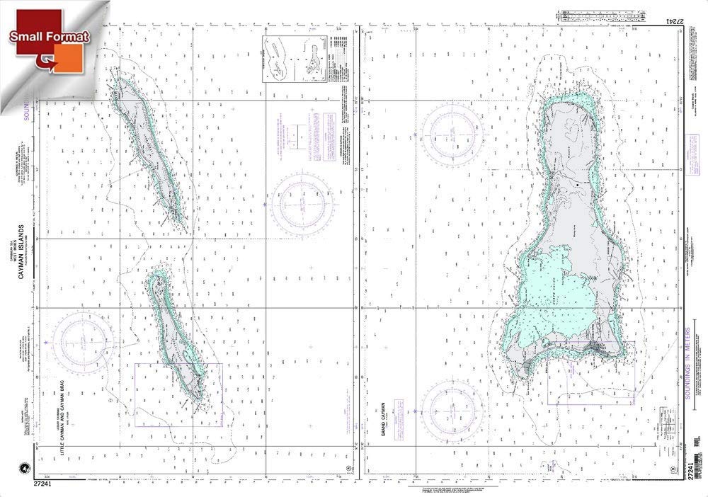
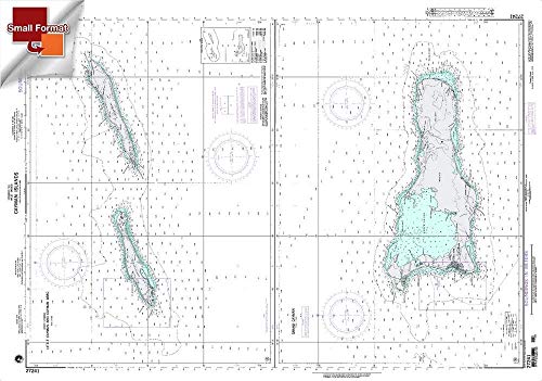
ItemName : Paradise Cay Publications NGA Chart 27241: Little Cayman and Cayman BRAC, Approx. Size 21" x 31" (Small Format Waterproof)
ItemPackageDimensions_Height : 26.1874 centimeters
ItemPackageDimensions_Length : 2.3876 centimeters
ItemPackageDimensions_Width : 16.51 centimeters
ItemPackageQuantity : 1
ItemTypeKeyword : fishing-charts-and-maps
Manufacturer : Paradise Cay Publications
MapType : waterproof, topographic, river
Material : paper
Material1 : Blend
Material2 : Blend
Material3 : Blend
Material4 : Blend
Material5 : Blend
ModelName : RFFG9-B
ModelNumber : RFFG9-B
NumberOfItems : 1
NumberOfPieces : 1
PackageLevel : unit
PartNumber : RFFG9-B
Pattern : Solid
ProductDescription : This BookletChart is made to help recreational boaters locate themselves on the water. It has been reduced in scale for convenience, but otherwise contains all the information of the full-scale nautical chart. The bar scales have also been reduced, and are accurate when used to measure distances in this BookletChart. This BookletChart does NOT fulfill chart carriage requirements for regulated commercial vessels under Titles 33 and 44 of the Code of Federal Regulations but it has been updated for chart corrections published in the U.S. Coast Guard Local Notice to Mariners, the National Geospatial Intelligence Agency Weekly Notice to Mariners, and, where applicable, the Canadian Coast Guard Notice to Mariners. These BookletCharts have been one of NOAA’s handiest navigation products, especially for recreational boaters. The began as a Coast Survey’s experimental butr because of their success they have now moved the BookletCharts from experimental stage into official production. Nearly 1,000 newly updated BookletCharts are available, they cover the 95,000 miles of U.S. coastline and the Great Lakes. These handy BookletCharts are smaller scale than our traditional paper charts, but they contain most of the information found on a full-scale nautical chart. NOAA’s nautical charts help to protect lives and property, and boaters should take advantage of these nautical products. Many boaters don’t use nautical charts, trusting local knowledge or their memories. But that can be dangerous, as seafloors constantly shift, shorelines erode, and dangers to navigation are discovered. BookletCharts will tell a boater about these developments, and will help ensure a safe voyage, whether it is around the bay or down the coast.
ProductSiteLaunchDate : 2020-06-05T19:51:57.032Z
Size : One Size
Style : Small Format Waterproof - 21" x 31"
SupplierDeclaredDgHzRegulation1 : not_applicable
SupplierDeclaredDgHzRegulation2 : not_applicable
SupplierDeclaredDgHzRegulation3 : not_applicable
SupplierDeclaredDgHzRegulation4 : not_applicable
SupplierDeclaredDgHzRegulation5 : not_applicable
TargetSpecies : Fish
UnitCount : 1
UnspscCode : 60101700