
Cart 2 india
In2Cart
Rs. 0
0


Product Information
Specification
AgeRangeDescription : Adult
Binding : apparel
Brand : Paradise Cay Publications
BulletPoint : Size (inches) - 8 ½ X 11
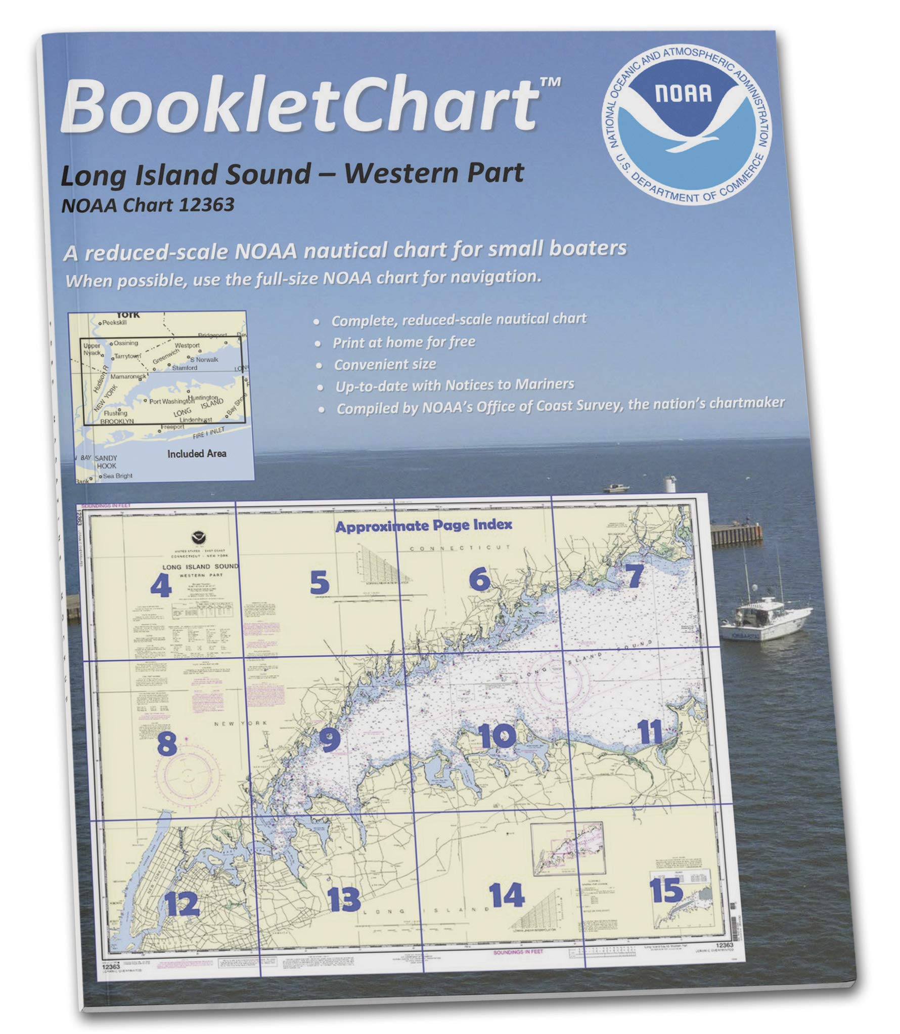
BulletPoint1 : An alternative to large, full scale charts which may too big to manage, especially on the water in a small vessel.
BulletPoint2 : Exact replica of the full scale version of the corresponding NOAA Chart 12363, just printed in smaller scale and offered in a booklet form.
BulletPoint3 : Your Booklet chart will be printed on demand for your order and will include all updates at the time of printing.
BulletPoint4 : Printed on high-quality durable paper with stapled (saddle-stitched) binding.
BulletPoint5 : Handy 8.5 x 11 inch size. Page count varies depending on the chart.
BulletPoint6 : Perfect Gift for All Anglers – Ideal for beginners, seasoned fishermen, kids and scouts, and any outdoor enthusiasts looking to master essential fishing knots.
CareInstructions : Hand Wash Only
Color : Multicolor
CustomerPackageType : Sheath Only
ExternallyAssignedProductIdentifier1 : 0617270065129
ExternallyAssignedProductIdentifier2 : 617270065129
ExternallyAssignedProductIdentifier3 : 00738875000404
FishingLineType : Fly
GpsrSafetyAttestation : 1
ImportDesignation : Imported
IncludedComponents : See description
IsCordless : 1
ItemDisplayWeight : 4 kilograms
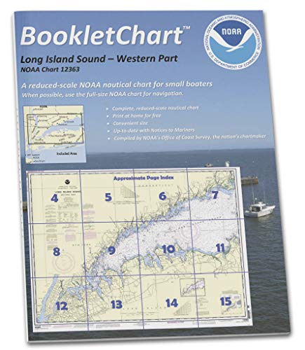
ItemName : Paradise Cay Publications NOAA BookletChart 12363: Long Island Sound Western Part
ItemPackageDimensions_Height : 21.59 centimeters
ItemPackageDimensions_Length : 0.254 centimeters
ItemPackageDimensions_Width : 13.716 centimeters
ItemPackageQuantity : 1
ItemShape : rectangle
ItemTypeKeyword : fishing-charts-and-maps
LineWeight : 6
Manufacturer : Paradise Cay Publications
Material : Plastic
ModelName : KNOT TYING CHART # 8
ModelNumber : 129314-Maurice
NumberOfItems : 1
Orientation : Vertical
PartNumber : 129314-Maurice
Pattern : Solid
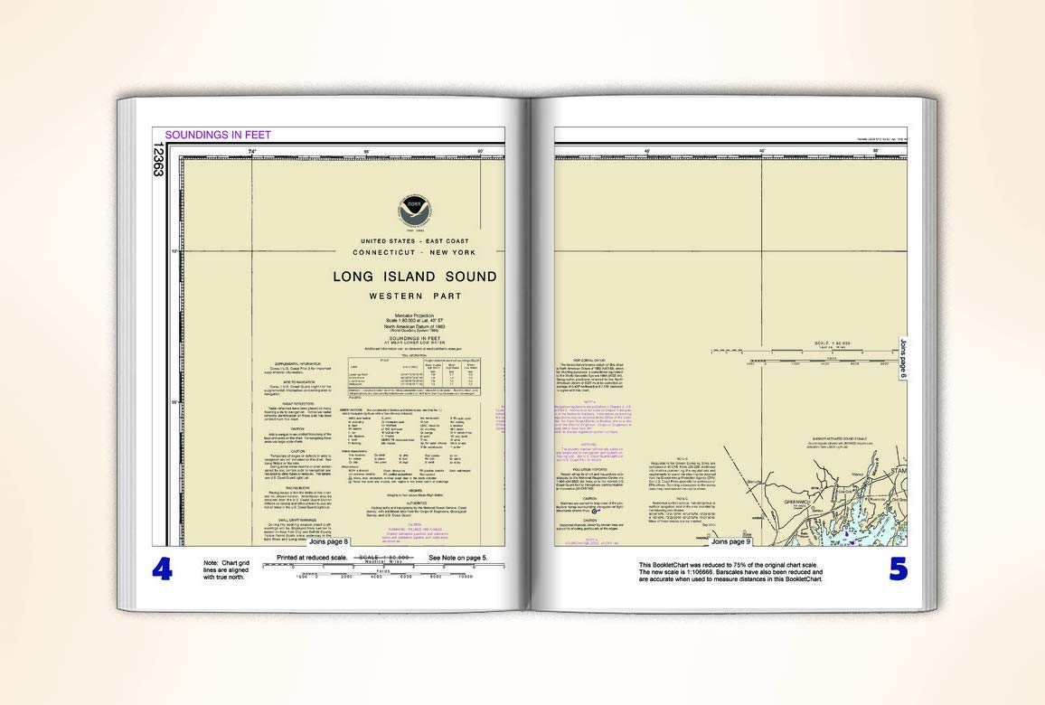
ProductDescription : This BookletChart is made to help recreational boaters locate themselves on the water. It has been reduced in scale for convenience, but otherwise contains all the information of the full-scale nautical chart. The bar scales have also been reduced, and are accurate when used to measure distances in this BookletChart. This BookletChart does NOT fulfill chart carriage requirements for regulated commercial vessels under Titles 33 and 44 of the Code of Federal Regulations but it has been updated for chart corrections published in the U.S. Coast Guard Local Notice to Mariners, the National Geospatial Intelligence Agency Weekly Notice to Mariners, and, where applicable, the Canadian Coast Guard Notice to Mariners. These BookletCharts have been one of NOAA’s handiest navigation products, especially for recreational boaters. The began as a Coast Survey’s experimental butr because of their success they have now moved the BookletCharts from experimental stage into official production. Nearly 1,000 newly updated BookletCharts are available, they cover the 95,000 miles of U.S. coastline and the Great Lakes. These handy BookletCharts are smaller scale than our traditional paper charts, but they contain most of the information found on a full-scale nautical chart. NOAA’s nautical charts help to protect lives and property, and boaters should take advantage of these nautical products. Many boaters don’t use nautical charts, trusting local knowledge or their memories. But that can be dangerous, as seafloors constantly shift, shorelines erode, and dangers to navigation are discovered. BookletCharts will tell a boater about these developments, and will help ensure a safe voyage, whether it is around the bay or down the coast.
ProductSiteLaunchDate : 2020-05-05T18:06:44.457Z
RecommendedUsesForProduct : Fishing, Hunting, Camping, Survival
Reusability : Reusable
ShipsGlobally : 1
Size : 8.5" x 11"
Style : BookletChart
SupplierDeclaredDgHzRegulation : not_applicable
Theme : Outdoor Activities
UnitCount : 1
UnspscCode : 60101700