
Cart 2 india
In2Cart
Rs. 0
0


Product Information
Specification
AgeRangeDescription : Adult
AnimalTheme : fish
Brand : UKHO
BulletPoint1 : Corrected up to the latest notice to mariner at the point of sale.
BulletPoint2 : Meets U. S. and international carriage requirements for commercial vessels defined in SOLAS Chapter V Regulation 19.2.1.765
BulletPoint3 : U. S. Coast Guard approved
BulletPoint4 : Produced by the United Kingdom Hydrographic Office. One of the world's leading producers of nautical charts.
BulletPoint5 : Shipped in a heavy-walled 2″ mailing tube with plastic endcaps
BulletPoint6 : Made in USA
Color : Poster
ColorFamily : blue
CustomerPackageType : FFP
ExternallyAssignedProductIdentifier1 : 0852680586547
ExternallyAssignedProductIdentifier2 : 852680586547
ExternallyAssignedProductIdentifier3 : 0787732468062
ExternallyAssignedProductIdentifier4 : 0740620901294
FinishType : Coated
GpsrSafetyAttestation : 1
IndoorOutdoorUsage : indoor
ItemDisplayDimensions_Length : 42 inches
ItemDisplayDimensions_Width : 28 inches
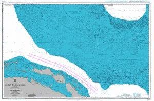
ItemName : UKHO BA Chart 2009: Sheet 2 from 23 deg 40 min North Latitude to Old Bahama Channel
ItemPackageDimensions_Height : 51.308 centimeters
ItemPackageDimensions_Length : 5.08 centimeters
ItemPackageDimensions_Width : 6.35 centimeters
ItemPackageQuantity : 1
ItemShape : Rectangular
ItemTypeKeyword : fishing-charts-and-maps
Manufacturer : United Kingdom Hydrographic Office
Material : Plastic
ModelNumber : fgpt-129
MountingType : Wall Mount
NumberOfItems : 1
Orientation : Portrait
PaintType : Watercolor
PaperFinish : coated
PartNumber : na
Pattern : unpatterned
ProductDescription : Admiralty standard nautical charts comply with Safety of Life at Sea (SOLAS) regulations and are ideal for professional, commercial and recreational use. Charts within the series consist of a range of scales, useful for passage planning, ocean crossings, coastal navigation and entering port. Mariners should always use the largest scale nautical chart appropriate to their needs. In particularly busy seaways such as the English Channel, Gulf of Suez and the Malacca and Singapore Straits, the standard nautical charts are supplemented by mariners' routeing guides which provide advice on route planning in these complex areas. Admiralty nautical charts are corrected to the latest notice to mariners (NTM) by our trained cartographer at the point of sale. It is the mariner's responsibility to maintain and correct the chart onwards to be in compliance with SOLAS regulations and to ensure safe navigation.
ProductSiteLaunchDate : 2014-04-24T19:48:36.142Z
RecommendedUsesForProduct : Home decor, Office decor, Educational decor
Size : 19L" x 27W"
Style : Tube
SubjectCharacter : Fish
TargetGender : unisex
Theme : Earth,Fish,Sky
UnitCount : 1
UnspscCode : 55101500
WallArtForm : poster