
Cart 2 india
In2Cart
Rs. 0
0


Product Information
Specification
BatteriesRequired : 1
Brand : Garmin
BulletPoint : Great Product
BulletPoint1 : Printed on PaperTyger, a lightweight, tear-resistant, water-resistant paper with a smooth matte paper feel.
BulletPoint2 : Printed on demand using the most up to date NOAA data and latest Notice to Mariners (NTMs) applied at time of print.
BulletPoint3 : Meets United States Coast Guard carriage requirements.
BulletPoint4 : Pre-production finishing for superior quality.
BulletPoint5 : Printed by East View Geospatial. Map scale: 1:20,000. Map size (inches): 126 x 89.
BulletPoint6 : Premium Chart Compatible: Humminbird provides the most complete offering of premium chart options to anglers everywhere. Get a complete view of the world below with optional charts from Humminbird's LakeMaster and CoastMaster products, as well as your choice of compatible Navionics charts.
BulletPoint7 : AutoChart Live: Create real-time maps of your fishing spots, with access to patented Humminbird LakeMaster features. Map depth contours, bottom hardness and vegetation as you drive your boat. Comes standard with eight (8) hours of built-in recording time and is compatible with AutoChart Zero Line SD cards for virtually-endless AutoChart Live mapping capacity.
BulletPoint8 : Includes control head, transom-mount transducer, power cable, gimbal mounting bracket and mounting hardware.
BulletPoint9 : 1-Year Limited Warranty
Color : Black
ExternallyAssignedProductIdentifier : 8680618318104
ExternallyAssignedProductIdentifier1 : 753759298487
ExternallyAssignedProductIdentifier2 : 0753759298487
FinishType : Polished
ImportDesignation : Made in the USA
IncludedComponents : Great Product
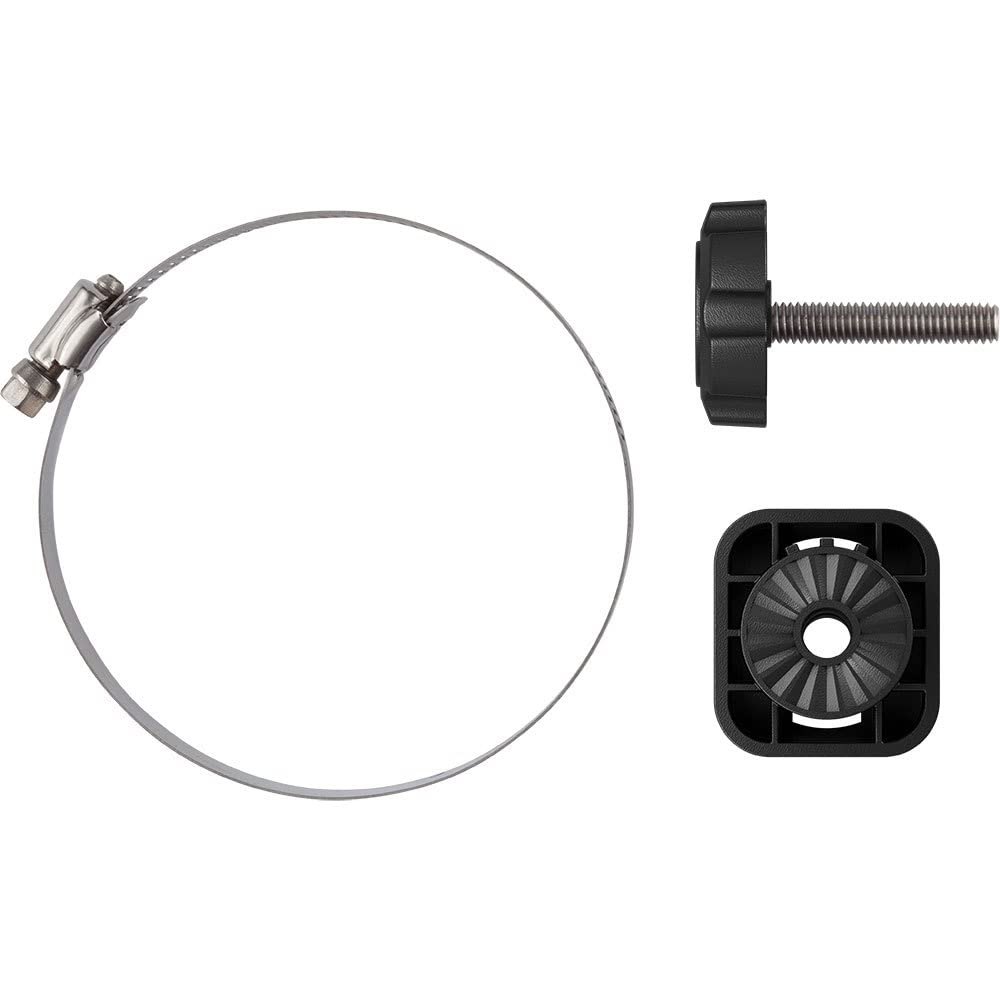
ItemName : Garmin Trolling Motor Barrel Mount f/Livescope Plus LVS34
ItemPackageDimensions_Height : 2 inches
ItemPackageDimensions_Length : 5 inches
ItemPackageDimensions_Width : 5 inches
ItemPackageQuantity : 1
ItemTypeKeyword : boating-gps-accessories
Manufacturer : Garmin
MapType : Navigational
Material : Plastic
ModelName : 010-13228-01
ModelNumber : a644dff3-9f12-4975-848f-07ef05180f9d
MountingType : Mount to transom, on the jackplate, under the step
NumberOfItems : 1
PackageLevel : unit
PaperFinish : matte
PaperFinish1 : matte
PaperFinish2 : smooth
PaperSize : 126 x 89 inches
PartNumber : 010-13228-01
Pattern : Solid
PowerSourceType : DC Power Supply
ProductDescription : East View Geospatial (EVG) is a certified NOAA and NGA print on demand printer. Our nautical charts are printed using high resolution images. All NOAA nautical charts are printed by East View Geospatial.
NOAA-OCS cancelled this Raster and PDF chart. The product will NOT meet U.S. and international carriage requirements for commercial vessels defined in SOLAS Chapter V Regulation 19.2.1.
Printed on PaperTyger, a lightweight, tear-resistant, water-resistant paper with a smooth matte paper feel.Printed by East View Geospatial. Map scale: 1:20,000. Map size (inches): 126 x 89.
ProductSiteLaunchDate : 2023-04-03T22:28:01.918Z
Size : One Size
StreetDate : 2023-10-01T00:00:01Z
Style : Fish Finders
SupplierDeclaredDgHzRegulation : not_applicable
TargetAudience : Adults
UnitCount : 1
UnspscCode : 25170000
WarrantyDescription : Warranty