


Screen Protector Designed for Northstar Explorer 5
₹7580 -30% ₹5300/-
T-H Marine SKLK-NAST-DP Shock Lock
₹71300 -38% ₹44200/-

Yo-Zuri R1409-HGBL: 3D Inshore Fingerling (Sp) 70M
₹5810 -38% ₹3600/-

Screen Protector Designed for Navman Fish 4500 Fis
₹11580 -30% ₹8100/-

Zig-ZAG/Oyster
₹4150 -30% ₹2900/-

Screen Protector Designed for Eagle SeaChamp 1000C
₹8040 -34% ₹5300/-

CERWIN Vega SL65F4B Marine Speakers Long Pod Syste
₹225890 -32% ₹153600/-

CERWIN VEGA SRPM1100.5D 980W RMS Full Range Class-
₹201910 -37% ₹127200/-
Screen Protector Designed for Lowrance LCX-18C Fis
₹8550 -38% ₹5300/-
Screen Protector Designed for Furuno NAVNET 1732 F
₹8040 -34% ₹5300/-

1st Mate Wearable Accessories - Wristband & Carabi
₹8310 -35% ₹5400/-
Screen Protector Designed for Navman Tracker 5380
₹8290 -36% ₹5300/-

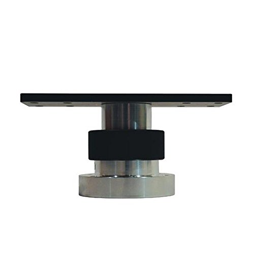
NavPod GP1040 SystemPod Un-Cut (usable face = 17.5
₹122360 -32% ₹83200/-

Rockville RGHR-ZA 4 Zone Marine Gauge Hole Digital
₹63090 -32% ₹42900/-

Yo-Zuri R1412-BN: 3D Inshore Popper (F) 120Mm 4-3/
₹5540 -35% ₹3600/-
Screen Protector Designed for Furuno NAVNET 1762 F
₹7800 -32% ₹5300/-

SEACHOICE 19501 4-Way Nylon Antenna Ratchet Mounti
₹8530 -39% ₹5200/-
Screen Protector Designed for Raymarine RL80CRC Fi
₹11580 -30% ₹8100/-
Screen Protector Designed for Furuno NAVNET 1720C
₹12090 -33% ₹8100/-
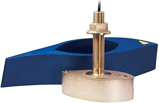
Lowrance XSONIC AIRMAR B275LH-W
₹822650 -32% ₹559400/-

Screen Protector Designed for Lowrance HDS-5 Gen2
₹13280 -39% ₹8100/-

Zig-ZAG/Chrome Black Back
₹4470 -35% ₹2900/-

NavPod PP5920-00 PowerPod Un-Cut (usable face = 18
₹203450 -39% ₹124100/-
Screen Protector Designed for Standard Horizon CP1
₹12660 -36% ₹8100/-
Screen Protector Designed for Eagle SeaCharter 642
₹7920 -33% ₹5300/-
Screen Protector Designed for Lowrance HDS-5 5m 5X
₹7580 -30% ₹5300/-
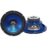
PYLE PLW10BL 10-Inch 600 Watt Subwoofer, Red
₹15510 -31% ₹10700/-

NavPod GP2050 SailPod Un-Cut (usable face = 12.75"
₹136820 -34% ₹90300/-
Screen Protector Designed for Lowrance X-26C Fish
₹7580 -30% ₹5300/-

Hobie Lowrance Ready Total Scan Plate Kit
₹14780 -33% ₹9900/-