
Cart 2 india
In2Cart
Rs. 0
0


Product Information
Specification
Binding : map
Brand : Generic
BulletPoint1 : Budget-friendly travel guides and itineraries
BulletPoint2 : Tips for stylish yet affordable travel
BulletPoint3 : Slow travel and cultural immersion advice
Color : Multi
CompatibleDevices1 : ARC1
CompatibleDevices10 : QUA1
CompatibleDevices11 : DC1
CompatibleDevices12 : GC1
CompatibleDevices13 : FC1
CompatibleDevices14 : SUC1
CompatibleDevices15 : TGT1
CompatibleDevices16 : RASPSB1
CompatibleDevices17 : SAC1
CompatibleDevices18 : TRNPL1
CompatibleDevices19 : AUC1
CompatibleDevices2 : MEC1
CompatibleDevices20 : ONX1
CompatibleDevices21 : ASC1
CompatibleDevices22 : THEC1
CompatibleDevices3 : SUN1
CompatibleDevices4 : TRN1
CompatibleDevices5 : RASP1
CompatibleDevices6 : RAS1
CompatibleDevices7 : MVRC1
CompatibleDevices8 : KNC1
CompatibleDevices9 : MUC1
ExternallyAssignedProductIdentifier : 9318923029239
Format : folded_map
Format1 : atlas
Format2 : folded_map
HardwarePlatform : Android
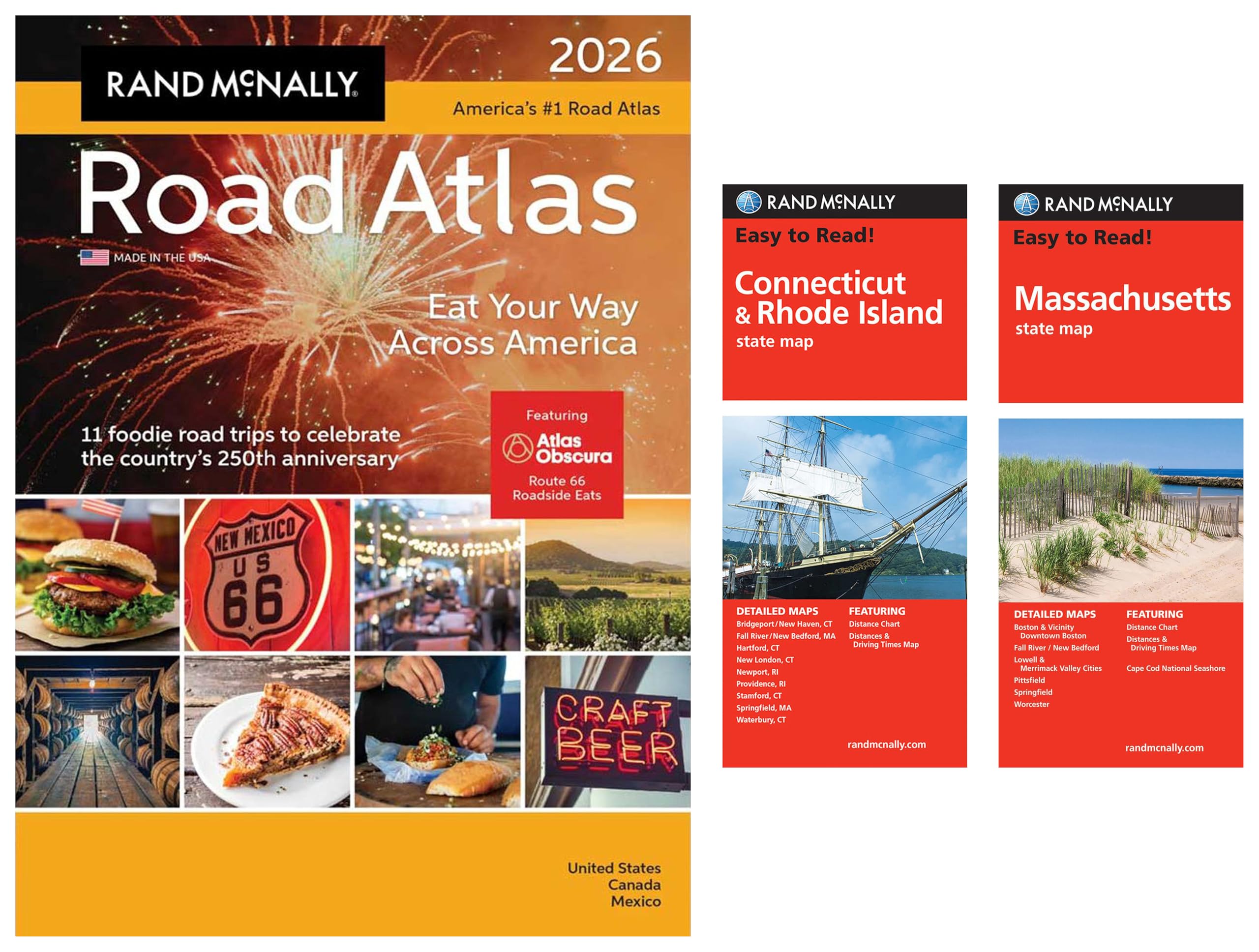
ItemName : 2026 Road Atlas with Easy to Read Connecticut/Rhode Island & Massachusetts State Maps
ItemPackageDimensions_Height : 2 inches
ItemPackageDimensions_Length : 16 inches
ItemPackageDimensions_Width : 12 inches
ItemTypeKeyword : outdoor-recreation-topographic-maps
Language : english
Manufacturer : Generic
MapScale : 500
OperatingSystem : Android
PartNumber : Generic
ProductDescription : Atlas: This 2026 Road Atlas contains the most up-to-date maps, more detailed city inset maps, and more travel planning information than the competition, which is why it’s been the essential, trusted tool for road travelers for more than 100 years.
Additional Features include: Maps out 11 culinary road trips that explore the best of America’s regional cuisine; Annually Updated Maps: Detailed coverage of every U.S. state and Canadian province with an overview map of Mexico; More Inset Maps: Detail maps for 375 cities and 28 national parks; Mileage Map: Distance and approximate driving times between hundreds of cities; On-the-Road Resources: Tourism, construction, and toll info for each U.S. state and Canadian province; Proudly Made in the USA
Folded Maps: These Easy To Read State Folded Maps are a must-have for anyone traveling in and around these states, offering unbeatable accuracy and reliability at a great value. The trusted cartography shows all Interstate, U.S., state, and county highways, along with clearly indicated parks, points of interest, airports, county boundaries, and streets.
These road maps have easy-to-use legends and detailed indexes that make for quick and easy locations of destinations.
Additional Features include: Regularly updated, full-color maps; 68% larger map with a bigger type size than regular folded maps; Clearly labeled Interstate, U.S., state, and county highways; Indications of parks, points of interest, airports, county boundaries, and more; Mileage and driving times map; Detailed index; Convenient folded size.
ProductSiteLaunchDate : 2020-11-12T21:40:58.014Z
PublicationDate : 2025T
StreetDate : 2025-05-09T02:00:00.000Z
SubjectKeyword1 : adventure bike commute course day trip drive
SubjectKeyword2 : excursion expedition foray hike jaunt journey junket
SubjectKeyword3 : navigate outing overnight rand mcnally ride round
SubjectKeyword4 : roundabout run safari sail sightsee tour transit
SubjectKeyword5 : transit travel trek trip walk wander weekend
SupplierDeclaredDgHzRegulation : not_applicable
SupplierDeclaredHasProductIdentifierExemption : 1
UnspscCode : 43230000