
Cart 2 india
In2Cart
Rs. 0
0


Product Information
Specification
Brand : YellowMaps
BulletPoint : This is part of the Push-Pull Switches Product Line for Cole Hersee
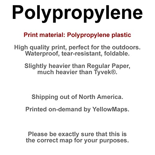
BulletPoint1 : Printed on Polypropylene (plastic)
BulletPoint2 : USGS topographic map of Seward, AK, at 1:250000 scale. Heavier material. Waterproof. Tear-resistant. Foldable. Perfect for the outdoors.
BulletPoint3 : Cities, towns, villages: Horseshoe Bay (historical),Cooper Landing,Sunrise,Dahl,Oceanic,Chenega Bay,Moose Pass,Snug Harbor,Muskwa Village,Lowell Point,Port San Juan,Lakeview,Kiniklik (historical),Latouche,Crown Point,Gilpatricks,Indian,Silvertip,Hope,Port Crawford (historical),Girdwood,Girwood (historical),Bear Creek,Golden,Falls,Woodrow,Port Benney (historical),Lawing,Port Ashton,Chenega,Seward,Alyeska,Whittier,Phoenix (historical),Wibel
BulletPoint4 : Islands: Wilby Island,Knight Island,Chicken Island,Channel Rock,Kiniklik Island,Applegate Rock,Esther Island,Perry Island
BulletPoint5 : Parks and forests: Bettles Bay State Marine Park,Horseshoe Bay State Marine Park,Turnagain Pass Winter Sports Area,Thumb Cove State Marine Park,South Esther Island State Marine Park,Taylors Creek Winter Sports Area,Entry Cove State Marine Park,Cooper Landing Historic District,Chugach National Forest,Surprise Cove State Marine Park,Two Lakes Park,Ziegler Cove State Marine Park,Granite Bay State Marine Park,Decision Point State Marine Park,Sunrise City Historic District
Color : Polypropylene
ConnectorType : Quick Connect
ExternallyAssignedProductIdentifier1 : 632850313001
ExternallyAssignedProductIdentifier2 : 0632850313001
ExternallyAssignedProductIdentifier3 : 00632850313001
Hazmat1 : LITHIUM ION BATTERIES PACKED WITH EQUIPMENT
Hazmat2 : UN3481
Hazmat3 : II
InternationalProtectionRating : IP00
ItemName : YellowMaps Seward AK topo map, 1:250000 Scale, 1 X 3 Degree, Historical, 1959, Updated 1959, 22 x 29.5 in - Polypropylene
ItemPackageDimensions_Height : 1.5 inches
ItemPackageDimensions_Length : 4 inches
ItemPackageDimensions_Width : 1.8 inches
ItemPackageQuantity : 1
ItemTypeKeyword : outdoor-recreation-topographic-maps
Manufacturer : USGS
MapType : Topographic
MapType1 : Topographic
MapType2 : Historical
MapType3 : Recreation
MapType4 : Historical
ModelNumber : 50002-BX
MountingType : Tabletop Mount
NumberOfItems : 1
OperationMode : ON-OFF
PartNumber : USGS-5661950-POLY
PowerSourceType : Battery Powered
ProductDescription : Printed on Polypropylene
ProductSiteLaunchDate : 2018-12-03T12:10:29.990Z
SpecificationMet : IP64
SupplierDeclaredDgHzRegulation : not_applicable
UnitCount : 1
UnspscCode : 55101500
WaterResistanceLevel : waterproof